Super Randonnée

Super Randonnée is a permanent ride that can be done any time throughout the year. The course is a minimum of 600kms (max 620kms), with a minimum of 10,000 metres of vertical climbing. The standard time limit is 60 hours. There are two rider categories for the SR600. Those riders intend to complete the ride within the designated time of 60 hours, and a tourist category, where a minimum average of 75kms per day is ridden. Upon completion, any rider aiming for the 60-hour limit who misses the time limit will automatically be classed as a tourist rider.

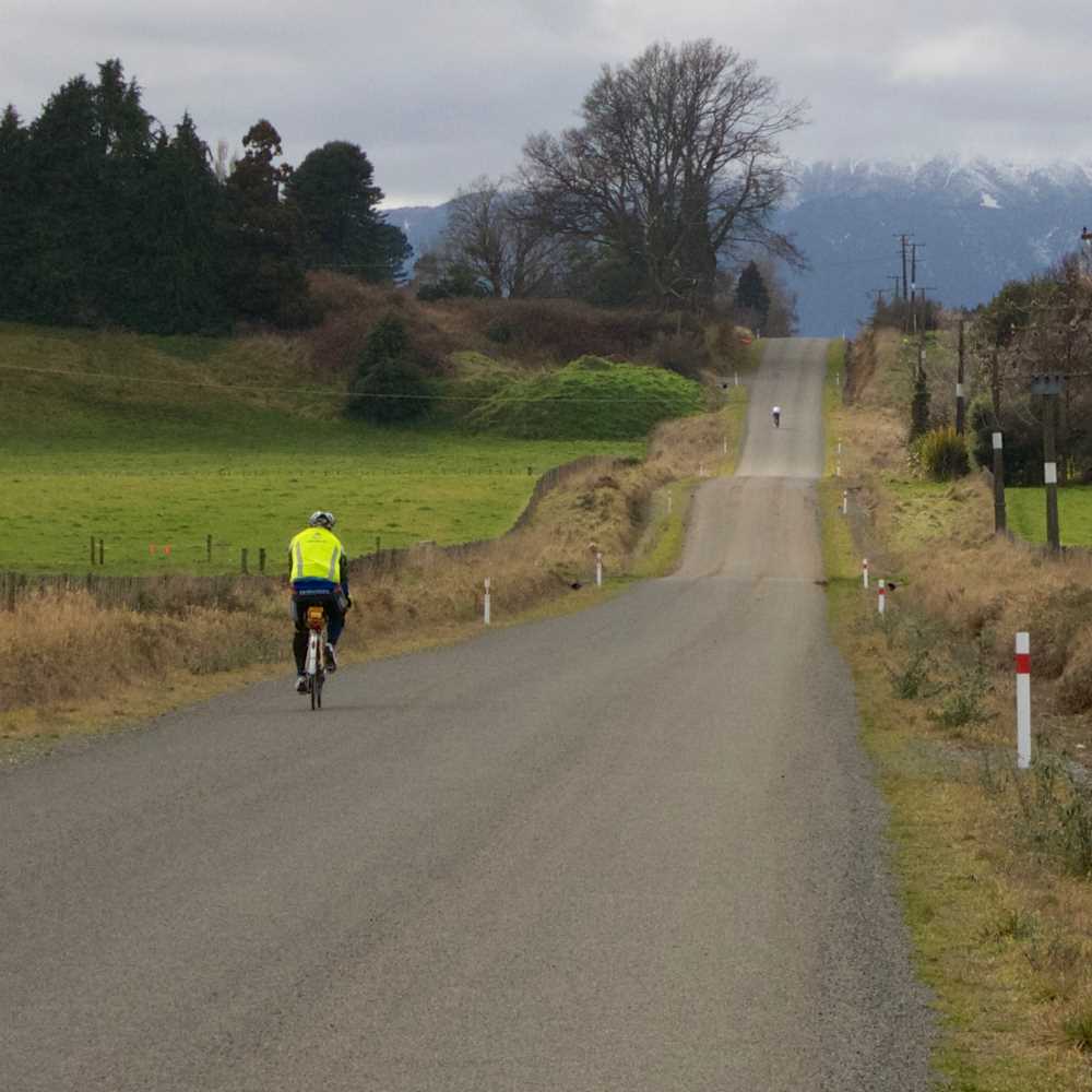
The SR600 is an individual endeavour. The rider chooses when to start. The ride must be unsupported. The control points are also unmanned. It will be up to the rider to validate their passage through the challenge.

More details and the general rules of the Super Randonnée can be found here:

https://www.audax-club-parisien.com/en/our-organizations/super-randonnees-en/

The contact for these rides is:

Kelvin Spicer

kelvinrspicer@gmail.com

Important points:

The ride can be done as a group or as an individual

Each rider must notify the organiser at least 30 days and specify the ride date and start time.

Tourists don’t have to specify a start date.

The start date can be altered by notifying the organiser up to a week before the ride.

An SR card and guidebook with controls will be sent out upon registration.

These rides are entirely unsupported, including the control points. It is up to the rider alone to complete the ride.

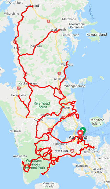
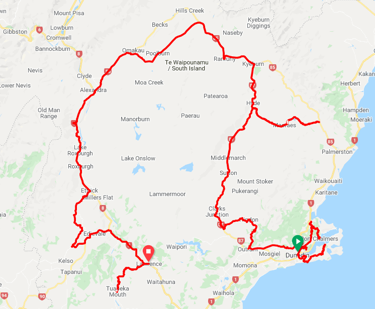
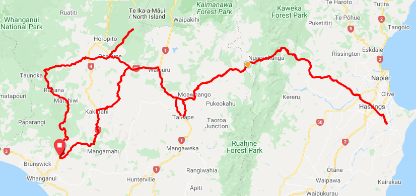
The difficulty in setting a course in New Zealand is that courses must be certified through Openrunner. This provides a double problem. New Zealand doesn’t have enough alpine passes to run rides through to get the significant vertical metre gains. On the contrary, though, the very hilly nature of New Zealand’s back country roads isn’t recorded on Openrunner with great accuracy. This often results in some areas losing as much as 10 – 20% of their vertical metres. For example, the Forgotten Highway in the Ruapehu district is genuinely forgotten. Thirty per cent of the vertical metres are lost.

After much mapping and remapping, we are pleased to be able to provide three very different Super Randonnée challenges.

AUCKLAND COASTAL SCENIC SR600

https://ridewithgps.com/routes/35079402

A completely different course again, the Auckland Coastal Scenic SR600 has the rider less than 50kms from a hot coffee or a cold beer at any point on the course. The most formidable challenge of this course is, Not to put on weight, with the abundance of cafés available.

Starting at the Parnell Baths and finishing at the War Memorial Museum, this course takes in Mt Wellington, Mt Eden, One Tree Hill, Huia, Piha, Scenic Drive, Karekare, Waiwera, Waimauku, Wellsford, Warkworth, the North Shore beaches, and the Auckland Sky Tower.

This course will require careful map reading, as there are loops and crossovers, especially around Scenic Drive.

The first 200kms has almost 4,500 metres of vertical climbing. After that, it levels out somewhat.

THE ROARING FORTIES SR600

https://ridewithgps.com/routes/36572751

​​​​​​​Operating in the Southern Latitude of 45-50 degrees South, The Roaring Forties SR600 is the southernmost Super Randonnée in the world.

This ride starts at the foot of Robbie Burns Statue, at the Octagon, in Dunedin; this wee ride will test your hill climbing ability as it tackles the steepest residential street in the world, Baldwin street, with a gut-busting 35% gradient at its peak.

The course runs along the Otago Peninsula to the settlement of Portobello before returning to Dunedin to complete the Baldwin Street challenge.

Next is Port Chalmers, and then to the Central Otago Region to complete a lazy loop around the Lammermoor Range. The course finishes in the town of Lawrence.

Be prepared for low cell phone coverage and distant food services.

Being so far south, in summer, the day light hours are around 16 hours, whilst in winter, you may get 8.5 hours of sunshine, plus a lot of snow.

WHANGANUI - THE LIVING RIVER SR600

https://ridewithgps.com/routes/34993555

​​​​​​​The Whanganui River is the only river in the world with a legal identity, with a legal person's rights, duties and liabilities.

This course starts and finishes at the entrance to the Whanganui National Park, just outside the city of Whanganui. It will take you to Hastings across the Ruahine and Kaweka ranges, on the Taihape Napier road. The furthest point of the course is at the top of Te Mata Peak, “The Sleeping Giant”.

The return trip goes up to the top of the Ohakune Mountain Road, to the Turoa Skifield. From there, it is a gentle downhill run beside the Whanganui River to complete the loop.

This is a remote course, where services and phone reception is limited. Note that between Taihape and Hastings, there are no service centres. This is a 160km section.

Also, note that Mt Ruapehu is an active volcano. The crater lake is prone to erupting. The following site provides updates on the status. Level 1 is everyday activity. Level 2 has a 2km exclusion zone. The Turoa Skifield is well outside of this. Any eruption may cause State Highway 49 at Tangiwai to be closed. The last eruption was in 2007.

https://www.geonet.org.nz/volcano/ruapehu